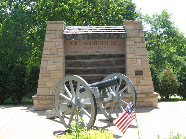
Fort McIntosh was the second largest fort (after Fort Pitt) on what was in the 1780’s the leading edge of European colonization of the American continent. There also First Peoples, thinking they were signing a legitimate agreement governing use of their land, ended up being the prey and foes of the nascent Americans. The Nomination Form for the National Register of Historic Places designation of this site is so informative that we reproduce it below. The author is not known to us. Bibliographic sources are provided at the end of the nomination form.
“Nothing remains of the original fort. About one third of the site is now a park, part is Borough street and the rest is occupied by private residences. The park itself overlooks the Ohio River and stretches for approximately one half mile on either side of the site.
Contemporary drawings of Fort McIntosh indicate it was composed of buildings of laid up logs forming an irregular square with raised bastions, at least two of them mounting iron cannon, at each corner. The whole was connected by log walk or palisades, and it is believed that the gate at the North end was protected by a semi-lunette. There were three barracks, capable of housing a regiment, warehouses, officers quarters, the Commandant’s house, forge and kitchen and powder magazines. Wide ditches surrounded it on three sides, the fourth being protected by a steep hill leading down to the Ohio River 130 feet below. A covered way provided access to water in case of attacks.
Drawings on two surveys made in 1785 by Daniel Leet and by John Lukens, Surveyor General, confirm this description, and a drawing which appeared in the Columbian Magazine in Philadelphia in 1799 shows the logs laid parallel.
Built under the direction of the Chevalier Cambray, a French engineer, while it was not nearly as large as Fort Pitt, Fort McIntosh was the second largest fort on the frontier, a far cry from the typical blockhouse.
Fort McIntosh was the first fort built North of the Ohio River by the United States and this, plus the transfer in 1778 by Gen. Lachlan McIntosh of the Headquarters of the Western Department to that site, represent a drastic shift in American policy. Now the United States were to take the offensive into the Indian country. (In a war, which after the first two years, was one of small armies operating over wide distances, McIntosh’s brigade was comparable in size to that with which Greene led the British to abandon their Carolina campaigns, and with which Lafayette and Wayne kept Cornwallis at bay until the arrival of Washington and the French at Yorktown.)
The Army, which was based at Fort McIntosh, two regiments of the Continental line, a troop of dragoons and 500 Virginia militia was the largest to serve west of the Alleghenies during the Revolution. In the original plan of Washington an Congress, the fort was to be the takeoff point for a campaign against the British post at Detroit, one of only two offensives planned by Washington in 1778. The way had been cleared by Articles of Agreement with the Delawares giving the United States the right to move an army through the land of its Indiana ally. Logistical problems, and a late start caused by the detour of the 8th Pennsylvania to the upper Susquehanna after Butler’s raid in the Wyoming Valley, changed the mission to one of harassment of the Indians.
In 1785, by the treaty signed at Fort McIntosh with the Delawares and Wyandott nations, the Commonwealth not only received clear title to all northwestern Pennsylvania for an additional $2,000, but the United States Commissioners, Arthur Lee, George Rogers Clark, and Richard Butler, imposed terms which moved the boundary of Indiana lands from the Pennsylvania-Ohio border to a line running from the mouth of the Cuyahoga to the mouth of the Muskingum.
This was the signal for the legislation by Congress of the Land Ordinance of May 1785, which established a standard policy for surveying and settling of all public lands. By September of that year, United States survey teams, some based at Fort McIntosh, were running the lines of the Seven Ranges from the point where the Ohio River leaves Pennsylvania, the first surveys of the Ohio country. The grid pattern used, with its sections set aside for educational purposes has been followed in mapping all territory acquired by the United States since.
Fort McIntosh was built on a high bluff, 130 feet above the Ohio River and a little less than one mile below the mouth of the Beaver. Within a half mile three major trails to the west and east intersected. The fort was a trapezoid, about 150 feet square, with the longest side close to the edge of the slope and parallel to the river. Ditches, approximately 15 feet wide surrounded the other three sides and bastions with raised platforms of earth taken from the ditches were at each corner, giving it the appearance of a five pointed star.
Forming part of the outer wall were barracks for a regiment, magazines, bakery, guard house ad hospital, all with roofs sloping toward the inside, and connected to the bastions by curtain walks of palisades. Inside was the parade plus quarters for officers, and two large storerooms. A gate facing NE was protected by a semi-lunette. It is not certain whether the bastions mounted two or four iron cannon.
On a single flagpole was the banner of the 13 colonies, but for some reason, General McIntosh flew a flag with 15 stripes.”
