Skip to content

Ohio River Parks Project

Drink the water! Eat the fish!

  • Home
  • The project
  • Analytic categories
    • Tree cover
    • Impermeable surface
    • Landscape design strategy
    • Access
    • Location
    • Interacting with the river
    • Information
    • Icons
    • Text
  • The Parks
    • Pennsylvania parks
    • Point State Park
    • Three Rivers Heritage Trail
    • Woods Run Fishing Club
    • Chestnut Street Boat Ramp
    • Leetsdale Industrial Park boat launch
    • Old Economy Village
    • Rochester Riverfront Park
    • Merrill Lockhouse 6
    • potential park
    • Ohio parks
    • River Museum Wellsville
    • USACE Pike Island Locks and Dam Fishermens Access Area
    • Powhatan Point Park
    • Monroe County Park and Marina
    • Hannibal Locks and Dam
    • Sistersville Ferry
    • Rest Area 10-1
    • New Matamoros Brick Street Boat Ramp
    • Frontier Boat Launch
    • Leith Run Recreation Area
    • Middle Island, Ohio River Islands National Wildlife Refuge
    • Newport Trojans Ballfields
    • Willow Island Locks and Dam
    • Ohio River Museum
    • Fort Harmar
    • SR 7 Scenic view
    • Lock and Dam 18 Ohio River Access
    • Belpre Civitan Park
    • Belleville Locks and Dam Park
    • Forked Run Ohio River access
    • Shade River scenic view
    • Shade River Access public fishing
    • Buffington Island Battlefield
    • Oldtown Creek Ohio River Access
    • Old Locks and Dam 23 Ohio River Access
    • Racine Hydroelectric Project park
    • Horace W. Karr Ohio River Boating Access
    • Star Mill Park
    • Syracuse Municipal Park
    • Pomeroy riverfront park
    • Dave Diles Park
    • Leading Creek Water Trail
    • Wilson Wetlands
    • Cheshire Community Park
    • Rest Area 10-22
    • Gallipolis City Park
    • Robert C. Byrd Locks and Dam Abutment Access
    • K.H.Butler Fishing Access
    • Crown City Wildlife Area
    • Proctorville town park
    • Symmes Creek boat launch
    • The Commons
    • Three State Overlook
    • South Point town park
    • Indian Guyan public launching ramp
    • Indiana parks
    • Lawrenceburg River Walk
    • Lawrenceburg Ratliff Landing
    • Aurora Ferry Park
    • Aurora Lesko Park
    • casino, Rising Sun
    • Rising Sun River Walk
    • Rising Sun Fryman’s Landing
    • Arnold Creek Launching Ramp
    • Patriot Launching Ramp
    • Patriot River View
    • Bryant Creek Launch Ramp
    • casino, Florence
    • Vevay Paul W. Ogle Riverfront park
    • Madison Heritage Park
    • Clifty Falls State Park
    • Bethlehem Boat Launch
    • Charlestown State Park
    • Duffy’s Landing
    • Greenway: Ohio River Greenway, Jeffersonville, Clarksville, New Albany Indiana
    • Ohio River Greenway
    • Falls of the Ohio State Park
    • Lewis & Clark Bicentennial Park
    • Greenway trailhead
    • New Albany Greenway
    • Casino, Elizabeth
    • Old Locks and Dam 43
    • Mauckport Boat Ramp
    • New Amsterdam, potential park
    • O’Bannon Woods State Park
    • Old Locks and Dam 44 Historic Park and boat ramp
    • Leavenworth, unnamed park
    • Harry O. Cummings Community Center
    • Schooner Point
    • Alton Community Park
    • Buzzard Roost Recreation Area
    • Magnet Riverside Park and Boat Launch
    • Mano Point boat launch
    • Mulzer Park
    • Wilkerson County Park and Boat Ramp
    • USACE Cannelton Locks and Dam Park closed
    • Eagles’ Bluff Welcome Center and Overlook
    • Mayor Hargis Park and Cannelton Riverwalk
    • Sunset Park
    • Troy, Public Access Site
    • Lincoln Ferry Park
    • Harold Schroeder Park and Boat Ramp
    • Rocky Side Park
    • Angel Mounds State Historic Site
    • Angel Mounds Boat Launch
    • USS LST 325
    • Evansville Riverfront Park
      • Evansville Riverfront Park Informative Plaques
    • Dogtown Boat Ramp
    • Old Henderson Road
    • Sherburne Riverbend Park
    • John T. Myers Locks and Dam Park
    • Illinois parks
    • Old Shawneetown
    • Cave-in-Rock State Park
    • Cave-in-Rock Ferry
    • Tower Rock Campground
    • River-to-river Trail, Elizabethtown trailhead
    • Rosiclare Park and Campground
    • Rauchfass Hill State Recreation Area
    • Trail of Tears
    • Lock 51 Park
    • Smithland Locks and Dam
    • Kincaid Mounds State Historic Site
    • Fort Massac
    • Dorothy Miller Park
    • casino, Metropolis
    • Joppa boat ramp
    • Grand Chain Lodge and Campground
    • Confluence of the Ohio and Mississippi Rivers
    • Howard Steamboat Museum
  • Blog
  • Contact

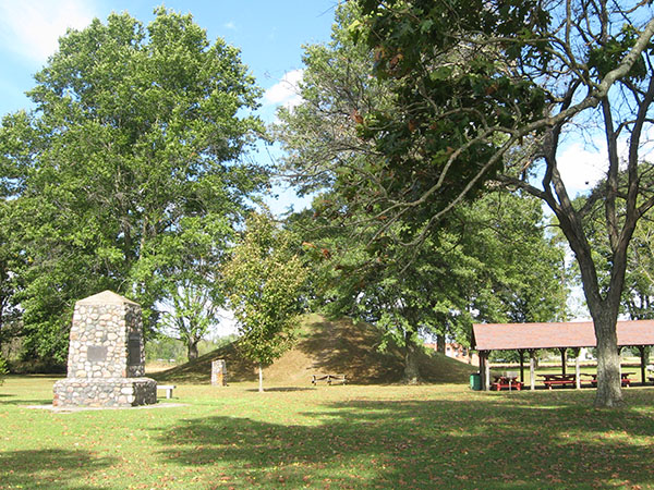
Buffington Island Battlefield

Ohio, Meigs County, Portland

river mile 217

217 OH Meigs Portland Buffington Island Battlefield park 600 8 high
park

Next park:    Oldtown Creek Ohio River Access

Field research October 2018

Share this:

  • Twitter
  • Facebook

Like this:

Like Loading...
Blog at WordPress.com.
  • Follow Following
    • Ohio River Parks Project
    • Already have a WordPress.com account? Log in now.
    • Ohio River Parks Project
    • Customize
    • Follow Following
    • Sign up
    • Log in
    • Copy shortlink
    • Report this content
    • View post in Reader
    • Manage subscriptions
    • Collapse this bar
 

Loading Comments...
 

    %d bloggers like this: